Wednesday, April 30, 2014

Day 6-7: Night Hiking and Warner Springs

The night before day 6 I stayed in Julian,  12 miles off trail. While in town, we decided to hit the trail late the next day and focus our time on night hiking. The hike from scissors crossing is a long waterless and hot stretch that is really tough in the the heat of the day. What further convinced us to night hike was the weather report....hot, hotter, and hotter the next three days. 
I am going to do a separate post dedicated to the thrills of night hiking when I have a few more nocturnal outings under my belt.  

So the plan was to leave town in the afternoon and start hiking when the sun was setting and hike through the majority of the night. We ended up leaving town much earlier than I would have liked, and because I wanted to keep up with Fiddy, I joined. At noon we started hiking; thr worst part of the day to begin hiking on a southern face in the desert.  


The afternoon heat is hard on everybody but for me it quickly becomes dangerous and reckless. My skin does not sweat at a normal rate so I can become quickly over heated. I dove under a bush at about 2pm when I was getting woozy from the heat. 

The desert is a bipolar mistress. In the beating sun you can over-heat and dehydrate in less than an hour, and in the shade, during that same hour you could be shivering. I'd rather be cold. 

I began hiking again at 7pm, after popping out of my refuge bush 3-4 times to test the heat. At this point the sun was casting dramatic shadows on the valley below and the temperature was dropping rapidly to a comfortable hiking temperature. Time to cruise!!


At first you think it's dark then it gets a whole lot darker. To quote the Big Lebowski: "darker then a black steer's tookus on a moonless prairie night". 


 I took down about 13 dark miles and called it a day at Barrel Springs. The sleepiness caught up with me and I called it a night earlier then I wanted but the trail will still be there tomorrow.  Overall, a great decision to night hike and I will be trying to go more nocturnal as the days pass. 

I woke up at about 7am and made my way to Warner Springs to take a long break until night fall. Awesome setup here. Ran by volunteers that make food and provide utilities for hikers. Tonight I will be attempting a dusk to dawn hike. Woowoo 


California cows are frisky

Tuesday, April 29, 2014

Day 5: Cruising with Fitty

It's funny how waking up late means something totally different when you are hiking. I usually try to get up at 4:30 or 5:00 am to get in as many miles as I can before the sunsets. Setting up camp in the dark sucks and It is nice to have some afternoon time to wind down the the day. The trade off is waking up very early. 
Today I didn't get up until 6:30am and half the hikers were already gone from camp. Fortunately a guy was getting ready to leave the same time I was and we took off together. The guy's name is Fitty(because he just turned 50) and he is a total stud. Last year he mountain bike raced the Continental Divide Trail! I did not even know that was possible or legal. Turns out it's sorta both. In his spare time he does adventure sports that I have never heard of: something with a 20ft kayak, a machete, and open ocean. Haha, anyway the dude is a tank and a great person to try to keep pace with. He has the same goal as me to do about 30 miles a day and to adapt around the weather to keep the trail from becoming too brutal; It is going to get rediculously hot in the next couple days with with the Santa Anna winds kicking up.  


Trail Magic: Silly name for good things that happen on the trail. Trail magic can vary from finding a quick hitch to getting free pie in town. Very similiar to trail angels but trail magic is much more random. 

The trail magic is already stacking up for this kid. 1) Fitty decided to pay for our hotel room in Julian after I told him about my cash flow situation. 2) We got a hitch into town pretty quick from a wonderful woman and her dog. 3) We got a free sandwich and pie in town just for being thru-hikers! 


We spent the night in the town of Julian about 12 miles off the trail at Scissors Crossing. The hotel was great and I got to rinse a few pounds of dirt from body/clothes and eat some hot food. All is well in the high desert. 

Day 4: back at the big miles

The Ozark Machine is back in action. Took down 28 miles today without any trouble. The miles flew by with a huge diversity in awesome landscape that you would not expect from the desert. 

hit the trail at 5:30am this morning hoping to beat the hot sun. The day started nice and easy just weaving out of camp. By the time the sun was up I was beginning the ascent to Mt. Laguna. After an easy 1000 ft climb I reached a beautiful mature pine forest that gave me some nice shade. I took a nap and made lunch.  The day was very cool compared to the heat predicted ahead so I tried to enjoy it as much as possible. 

I am camping at Mt. Laguna Campgroud with 8 other PCT hikers. Spirits are high and looking to do 30 miles to Scissors Crossing tomorrow. 

Saturday, April 26, 2014

PCT day 2-3: shin splints, stir crazy, rain

I spent 2 days at the kickoff party. Originally I was only going to spend one but my right leg had a bad shin splint leftover from the Ozark trail. Lots of free food and trail talk healed it right up. 

The kickoff party had many presentations about backcountry skills and PCT safety. This year the PCT desert section is very low on water and there will be 30 mile sections without water resupply!

Speaking of water in the desert, it rained like crazy the second night of the kickoff party and I had to restake my tent at 3 in the morning. Stayed dry otherwise so no big deal. 

Taking off tomorrow for much more interesting blog topics. 

Friday, April 25, 2014

Pct Day 0-1: Arrival-Kickoff Party


So many awesome things have happend in the past 36 hours. The community and culture around the Pacific Crest Trail is like nothing I have ever seen. 

The fun started outside the San Diego airport terminal when I met my first PCT hiker. He was waiting for the same trail angel as me and we had a great chat about gear and planning. Shortly after we got picked up by "Action Pack" in an old beat up van with 4 other hikers going to "Scout" and "Frodo's" house for the night. 
Confused yet? Let me explain all of this gibberish. So, "trail angels" are a network of volunteers that put in varying amounts of time, money and, energy into helping PCT thru-hikers. This work can range from hosting hikers at their homes, driving them to the trail head, making them food, and stocking desert water caches. Most of them have thru-hiked the PCT which means they have established trail names. Trail naming is a big part of the thru-hiking community. Every thru-hiker receives a trail name at some point. The purpose of trail names is to make it easier for everyone to remember who they have talked to and who they are referring to. For example there is a guy who's name is Gary, but he goes by "Monkey Wrench" on the PCT. That nickname is easy to remember and there is no other "Monkey Wrench" you could be referring to.
Another reason for trail names is to perpetuate the sillyness that is thru-hiking. People who decide and go thru with hiking long distances are the most easy going and fun loving people you will meet. Everyone is so used to adapting and dealing with challenges that when they aren't walking they are looking to have good time. Trail names are apart of the charm. The only rule with trail nicknames is that you cannot give one to yourself. I'm still waiting for mine. 

My first expereince with trail angles was "Scout and Frodo's" house, which is an institution for PCT thru-hiking. They spend the entire spring and early summer hosting hundreds of hikers in their home for free. They pick every hiker up from the airport, feed them dinner and breakfast, and drop them off at southern terminus of the trail. I was blown away by alll of the effort that they put in. They work non-stop from 5am-midnight everyday to make our experience great. Their house was bursting at the seams with excited hikers during my stay and most of us cow-boy camped in their backyard. 


Day 1:

We left "Scout and Frodo's" for the border around 6am after a big breakfast of eggs, fruit, and muffins. The border is about an hour and a half from San Diego. This was the busiest day for thru-hikers starting the trail and their was about 30 people in our group picture in front of the monument. I took a few pictures there and mingled but mostly wanted to get hiking so I took off. 
At 8:40am the desert was already super bright and warm. Very comfortable for hiking and enjoying the scenery but you could tell it was going to get really hot. Everyone was carrying 5 liters+ of water because there is 20 miles before the next water stop at Lake Morena. I hiked alone for a good portion of the morning just soaking in the magnitude of the journey I was beginning. By 10:00am the desert was getting hot and taking a noticeable amount of energy away from me. In the Ozarks I would take around 3-4 short breaks a day but yesterday I took about 3 long breaks and 15 short breaks just to get out of the sun and prevent heat stroke. I will do my best to not hike in the afternoon anymore but yesterday a late start was unpreventible. It is just way too hot and hard for my skin and body to be exposed in the afternoon sun here. I also decided to get anumbrella because the buff I am using is way too hot.
I hiked the afternoon with a few other people and the conversations made it allot easier to deal with the heat.


 I made it to Lake Morena campground and the kick-off party around 5:00 pm. Besides being really hot and having a shin-splint on my right leg(Ozark Trail leftover) I felt good. As soon as I got off the trail I was given a beer and a pat on the back for making the first 20 miles. Everyone here is awesome and hugely supportive and helpful. Tips and advice are everywhere to be found but no one is telling you what to do or how to best thru-hike. The best way is what works for you.


I've been really surprised to find that I have the smallest and lightest pack that I've seen. I am the only person that I know of that is sub 10 pounds. Can't help but be a little smug about this. 


The kick-off party runs until Sunday but I think I will be taking off on Saturday to get ahead of the crowd and get some miles down. Besides my shin splint I feel good and I hope it heels up on this day off.


Wednesday, April 23, 2014

Ozark Trail Thru-hike: Recap and Lessons Learned

Lesson 1: save your blogs in progress or you will want to punch out an airplane window when you lose a post that you worked on all afternoon. It was witty, informative and impossible to reproduce with the same grace. This is whatcha get now.


Ozark Trail!

The Ozark trail  was an incredible and extremly difficult week that taught me allot about what I can expect and prepare for the Pacific Crest Trail. I got to see the Ozarks transform from a stark winter scape into a green and flower laden spring. Overall the week flew by and I accomplished mileage that I had no idea I was already capable of. I am currently in route to San Diego. Day 1 on the big-boy trail is tomorrow!


What is the Ozark Trail?

The "OT" is a 230+ mile contiguous path, with the majority flowing through the Mark Twain National Forest. Over 95% of the trail is devoted to foot, bicycle, and horse traffic. This keeps the trail narrow, rugged and preserved from the harsh use of motorized vehicles. Almost all of the trail is covered in rocks sized from pebbles to boulders and the trail is hardly ever flat. Currently the trail is covered in leaves making the trail a bit hard to follow and small rocks are well hidden. I have done big mountain hiking and I would say the Ozark Trail is comparable in dificulty just without the elevation.
During the spring, cold, clear, and delicious water is very easy to find on the trail. I think I was crossing between 5-15 water sources everyday. I ran all my water through a simple Sawyer filter and it tasted as good as bottled water. 
Camping along the trail is all primitive campsites. That means no toilets, showers, and electricity. It also means it's free to camp and there is plenty of wonderful spots every 10 miles or so. I don't know why people go camping just to be crowded in with a bunch of other people, but if you like that than the OT might not be for you. 
The trail is maintained, and marked extremely well every 100 ft (+-). With the use of maps and directions it is very hard to get lost. 
The Ozark Trail is a Missouri treasure that should not be missed if you enjoy hiking or the out-doors. Every section has highlights that make it worth visiting but my favorite sections are Current River and Mt. Taum Sauk-Johnson-Shutins. 


Lesson 2: "if your tired pullover"

This lesson has to do with long-distance and speed-hiking but I think it can easily relate to other sports and activities. 
The goal of my OT hike was to finish the entire trail in 8 days so I had one day rest before leaving for the PCT. 9 days was not really an option and as soon as I started the trail I got the thru-hiker bug so a quick and consistent clip was a must. 
The first few days my tactic was to push myself until I had to take break. Meaning I  would end up shleping a mile or two slowly and with bad form. I thought this tactic was the way of the super athlete that puts up huge miles day in and out and is always saying "one more", simply by force. Like most things I learned the hard way and by the third day I changed my tactic from reacting to the need for a break to anticipating a need for a break. By taking breaks before I needed them I accomplished 3 things: I kept my spirits high by not allowing myself to get too tired, bored, or hungry. I kept my blood sugar from dropping which is usually the reason your body asks for a break, and I rested my feet in cool streams more often to keep them ready for more miles. Listening and pampering your body is crucial to staying healthy on a thru-hike.

 
Skin:
I was very lucky to not get any blisters on my feet or have any problems with my legs. My skin was very unhappy for the first few days like I anticipated. My back, thighs, and triceps were rubbed raw by the second day. I was most comfortable actually walking so when I woke up I just got going and tried not to think about the pain. Once I started sweating a little bit my skin felt much better. By the end of the trip my skin had mostly exfoliated and healed from the chafing. I used lots of Vaseline on problem areas and that seemed to heal it up and prevent further chafing. My hands struggled through out the week with cracks. I used Lucas' Pawpaw and latex gloves at night to minimize the damage but cracks are inevitable. By the end of the week I was certainly looking forward to a hot shower but I wasn't dying for one. 


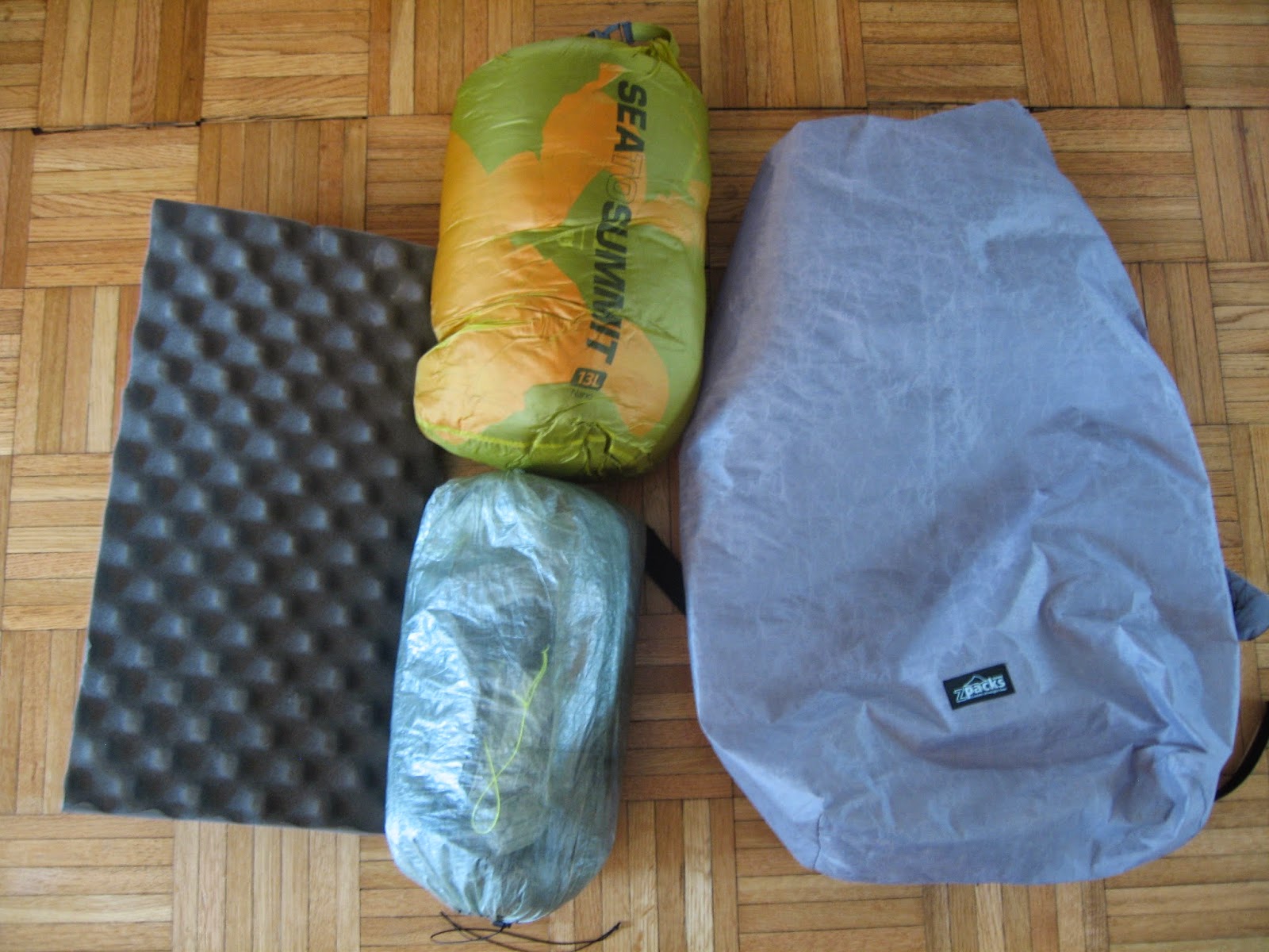
All of my gear held up well and I am very happy with all of my decisions there. 

Sunday, April 13, 2014

Complete PCT Gear List:


I have spent months researching and selecting the gear for my PCT thru-hike. Here is the complete list of every single piece of gear and its weight and msrp cost. Some of the gear is used, purchased with a pro-deal, split with a friend(the tent), or was a gift, so the cost does not directly correspond to my out of pocket expenses. It will however, give you a good idea of what it costs to build an excellent ultra-light kit like mine. Every item that has a website associated with it will be a link. 

Thank you for your donations and support; this would not be possible without you.


PCT GEAR LIST (6 SYSTEMS):

1) SLEEP AND BACKPACK:


2) PACKED CLOTHING:
Totals- 25.7oz/$418

3) Hydration and Kitchen:

4) Hygiene and Safety:
Totals- 11.6oz/$48(+-)

5) ELECTRONICS AND NAVIGATION:
Totals- 21.6oz/$562(+-)

6) Worn and Carried Gear (Weights are N/A)

GRAND TOTALS:  
BASE PACK WEIGHT: 9.3LBS
TOTAL ESTIMATED COST: $2,565


For some reason the third video will not come up on the page so follow this link for the last video.
https://www.youtube.com/watch?v=9x-VAnwPu8A


Thursday, April 10, 2014

Resupply Strategy-14 Days Out!!

Hiking the the Pacific Crest Trail requires 20 or more resupply stops that are spread 4-8 days apart. Many of the resupply points are small towns that run close to the PCT(usually require hitchhiking to get to) and most have grocery stores that provide all the needed supplies. There is a few resupply points that only offer a post-office or small general store, for which, mailing a resupply package is advised.

Mailing Packages:

Most hikers will mail at least some packages to themselves along the trail and some use this as their only source of resupply. 

Pros: You don't have to go shopping in towns. Your mailed box can better provide for your specific dietary needs. With your resupply box you can add maps and other gear that you might need along the way. Might be the only way to get food at certain resupply points.

Cons: Mailing boxes from your home address can get very expensive. You have to rely on someone to mail your boxes and add things you request before they are shipped. The bulk food you buy before the trip to fill all of your resupply boxes may be much more boring than you thought but now you are obliged to eat it. If you end the trip early you are left with tons of trail food. Post offices may be closed when you get into towns causing delays.

Buying supplies along the way:

It is possible to hike the entire PCT without mailing yourself one resupply box! 

Pros: Often cheaper than mailing your self resupply boxes. Supports local towns along the PCT. No reliance on friends or family to mail boxes. Takes much less planning and effort than mailing boxes. You are able to pick and choose new food items based on your shifting palate.

Cons: Some resupply points are only gas stations or resort shops that offer little selection and may be expensive. 

My approach:

Before the start of the trail I will only be packing one resupply box to mail to the first resupply point, Warner Springs. Warner springs does not have a grocery store or a good place to buy food so it is an obvious spot to mail a package. After that, my resupply strategy will be a mix of the two described above. The difference with my resupply strategy is that I will build my boxes in towns that offer a good selection of food and then mail the boxes ahead to resupply points that don't. It will be cheaper to mail boxes from inside the state and I suspect I will only need to mail 4-5 boxes the entire trip. 

I chose this method because it seems to make the most since for my budget and style of hiking. Some sections will go faster then I expected and some will go slower. By not relying heavily on mailing packages to myself I will be less tied to a strict pace. 

With all of the PCT resources online it is pretty easy to figure out where you will need to mail a package.  This is a good place to start. Craig's PCT Planner


Tuesday, April 8, 2014

A bear here, a bear there, hungry bears everywhere!

What's big, hates surprises, stinky, hairy, hungry, 230lbs and stands over 6 foot on its hind legs? Me, after a week in the backcountry, or a common black bear. 


The spot of my first black bear in-counter
Bears are far from the most dangerous thing on the Pacific Crest Trail, but seem to be on the forefront of everyones mind. I keep getting questions like "what if a bear attacks you?" or "are you trying to keep your pack light to out-run bears?"or "are you bringing a gun for the bears?" As much as I would enjoy a nice bear steak at the end of a long hiking day, I don't think lugging a .45 Magnum would be worth it, or give solace to more rational fears like lightning strikes, heat stroke, and dehydration.

The easiest way to cut through the irrational fear of our big furry friends is to do the numbers. 

  • There is 700,000-900,000 black bears in North America. On average less than one human is killed by a black bear yearly. Grizzly(brown bear) attacks are a bit more prevalent killing about 2 people every year.


  • Worldwide, For every one person killed by a black bear(the over-whelming more prevalent species of bear encountered on the PCT), 13 people are killed by snakes, 17 by spiders, 45 by dogs, 120 by bees, 150 by tornadoes, 374 by lightning, and 60,000 by other humans. 

Of course, subjecting yourself to months in bear country would raise your risk of encountering a dangerous bear, so arming with knowledge is important, however small the risk. In most cases, bear related deaths could have been avoided with proper knowledge of bears and their habits. Here is some crucial information to remember if you are spending time in bear country.

How to keep yourself Safe in bear Country:

1) DO NOT RUN! 
Running is never an appropriate response to any type of bear encounter. This includes all species of bear. Running can trigger the bears instinctive response to chase you as they would in a normal predator-prey relationship. Bears can run up to 30mph; you can not out run a bear!

2) Hike in a group of three or more and make noise.
 Many bear attacks are a result of bears being surprised by hikers. To prevent this, hike with more people and talk so bears know you are coming. Also a larger group is less likely to be attacked because bears are not dumb. more people = more danger.

3) Far encounter Vs. near encounter. 
If you see a bear off in the distance (>100yards) you don't really need to do much. Try to enjoy seeing such a beautiful animal and give it space to go about its business. The bear will probably scent you and move on or it will visually recognize you. If the bear notices you, give it time to move out of the area. If the bear does not notice you, walk around it, giving it plenty of space. If you come upon a bear that is close (<100yards) stop moving forward and raise your hands in the air making your self look big. Speak in a deep strong voice. The bear may approach you or stand on its hind legs to get a better look. This is not a threat. You can slowly back away from the bear as long as it doesn't follow. 

4) Dealing with an aggressive bear.
If you do all of the steps above the likelihood of a bear attacking you is slim to none. If the bear shows signs of aggression and charges at you, stand your ground and make as much noise as you can to show the bear you aren't to be f%cked with. If the bear still attacks at this point you are going to be eaten so thats about it. Just kidding. Playing dead can be successful in making the bear think you are no longer a threat unless the bear is truly interested in eating you. If thats the case, you will notice that bear is taking large chunks of flesh from your body. That would be the time to continue to fight.

5) Bears at camp. 
Store food at least 100 feet from camp in a bear-proof container or by using a proper bear-bag hang from a tree. If a bear comes near your campsite or food storage you should basically go berserk. A bear near your campsite knows you are there and has the huevos to come close, so you need to teach it a lesson. You want it to be so frightened by humans that it tells its bear buddies and bear neighbors to stay away. Throw rocks or trekking poles or sticks, and make as much noise as possible while doing it. If you are in your tent use it as a Wizard of Oz effect and shake and shudder while screaming your arse off.

6) Pack out all food and trash
If you leave food behind, bears will thank you by tearing open your tent to give you a hug.


There you go. Now you are ready to run off in the woods and cuddle with fuzzy bear cubs.....


Thursday, April 3, 2014

Stacks on Pawpaw!

The goods!!
Yesterday, I received my first sponsorship package from Lucas' Pawpaw! They pulled through with over $300 of their magical Papaya ointment; shipped directly from their Brisbane Australia factory. Lucas' Pawpaw has been using the same strange but tried-and-true recipe for the past 100 years that includes fermented papaya(pawpaw). Fermented papaya acts as a mild disinfectant and antioxidant that is perfect for healing minor cuts, cracks, and burns. I Can't wait to put their product to the test on the trail; this stuff is on a very short list of lotions I would depend on in the backcountry, and may turn out to be the only one I need. 

Regardless of skin-type this stuff can work wonders on a long list of topical ailments, including "nappy-rash" which I think is Australian for butt-chafe or diaper rash. Lets try to use it in a sentence: While at Maccas, Jack explained to Bill that he had to wear his trackies because he had a bit of nappy-rash on his bum from a week spent in the Bush.
Maccas: McDonald's
Trackies: track suit 
Bush: rural Australia

I will be doing independent reviews of this product as my trip progress. Although, I am very thankful for Lucas' Pawpaw's sponsorship it will not bias my final opinion on their product....but I have used this stuff in the past(not hiking) and I know it's awesome for normal everyday use. Thank you Lucas' Pawpaw, and my studly brother Eric for reaching out to them! 


Wednesday, April 2, 2014

Basic Information on the Pacific Crest Trail


PCT STATS:

Start: US/Mexico Border

Finish: Manning Park B.C. Canada

Total Length: 2,663 miles

Highest point:(Forester Pass) 13,153ft

Lowest point:(Oregon/Washington Border)143 ft

Total elv. gain: 314,711ft

People who attempt to thru-hike the PCT yearly: 700-800

Percent of people who finish: 60%+-

Modes of transportation: horseback or foot

Number permits needed: 1

Bears: Yes

The Pacific Crest Trail is a 2,650 mile contiguous path that runs from Mexico to Canada over the ridge of the Sierras. About 750 people attempt to thru-hike the trail yearly, most starting at the southern terminus in the month of April.

The trail starts in the desert mountains of Southern California where temperatures can range from a chilly 30 degrees at night to a scorching 100 degrees during the day. The desert will likely prove to be the biggest challenge for me because my skin does not regulate temperature well and burns easily. I will have to be adaptable and do what ever I can to stay safe and get in miles. This means I will probably be doing a large portion of the desert hike at night when temperatures are much more bearable. I will go into detail on night-hiking on my blog.

After the 700 mile dessert stretch, the trail climbs high into the Sierra's of Central California where the most revered part of the trail cuts through the gorgeous mountain landscape; lakes, streams, day-hikers and, bears are abundant.

Northern California makes way to more mountains as the Sierra's butt up against the Southern Cascade Range and eventually dive down into Oregon.

The Oregon section of the trail is relatively flat and considered the easiest and most boring section among thru-hikers.

Washington seems to be the wild card of the trail as far as weather and terrain go. If I make it to Washington in late July the weather should be fairly stable allowing me to hike without being blocked or slowed by snowfall or heavy rain. Towards the end of the summer season Washington can experience heavy snow as early as August causing the PCT to be to dangerous to finish.  

Whatever I think I know about the trail right now may be right but it is far from actually experiencing the trail day to day. It is easy to sit at home and say: "yeah i'll do 30 miles a day" or "night-hiking won't scare the shit out of me" or "when I make it to Washington..."

I am confident in my abilities but not arrogant enough to say that I am not nervous, and if I am not properly humbled by this trail already I certainly will be before it's over.

Photos by Half Mile: http://www.pctmap.net/maps/ 

Why "Hike on the Good Foot"?

I made a short video that explains my skin disease(Ichthyosis) and why I am raising funds and awareness to support those affected by it. For more information and a place to donate please follow the link below.

Brian's Pacific Crest Trail Thru-hike for Ichthyosis Research and Awareness